Saturday, June 25, 2011

Southern Utah - a dramatic finale to our trip

  From the North Rim, we headed across the Colorado Plateau to stop at Zion National Park.  This had been one of my biggest goals in taking the trip, so I was particularly excited about the opportunity.  We were able to stay in a campground right inside the park called the Watchman Campground, named for the nearby peak that towers over it.  Zion is one of the most popular of the Utah parks, and justifiably so.  The dramatic sheer sandstone walls throughout the canyon provide endless astounding views in all directions.  We wore out our digital camera taking pictures, but none of them can capture the overwhelming grandeur of the site.

The park is well served by a bus shuttle system that carries visitors between the many sites near the park entrance.  We made good use of that, and spent much of our visit riding back and forth between shuttle stops.  Many stops also provide hiking opportunities, some much more demanding and dramatic than others.  We tended to hike the shorter and less demanding routes, but they were very dramatic and beautiful all the same.  We hiked up the Watchman trail, the Canyon Overlook trail, the Riverside walk, and a somewhat longer trail to the Emerald Pools.  All provided spectacular views and the occasional view of critters.

One rather surprising treat was the profusion of desert wildflowers along the hiking trails.  There were flowering plants clinging to rock faces in the most unlikely places, and the early June season was perfect for flowering cactus and many other small and delicate desert flowers.  We took lots of pictures.  There was a lot of seeping water coming out of the sandstone in some spots, and that created hanging gardens that were quite lovely and cool amid the heat of the day.

The shuttle system allowed you to put your bike on the bus, and I took advantage of that while Ivy was doing some afternoon drawing and painting.  By riding the shuttle to the end of the line up-canyon with your bike, you could bicycle all the way back downhill and stop wherever you wanted, at places that were not part of the regular route.  There were some lovely spots by the river and some very restful and beautiful places that I got to enjoy with a bit of solitude.

Leaving Zion after a very enjoyable stay, we headed north again for a brief overnight stop at the Kodachrome Basin State Park, a very charming and rather remote pile of sandstone rock in the outback of Utah.  The park was lovely and quiet, with glorious views all around the campsite.  This site is known for sandstone pipes, which are special formations that evolve in the area. 

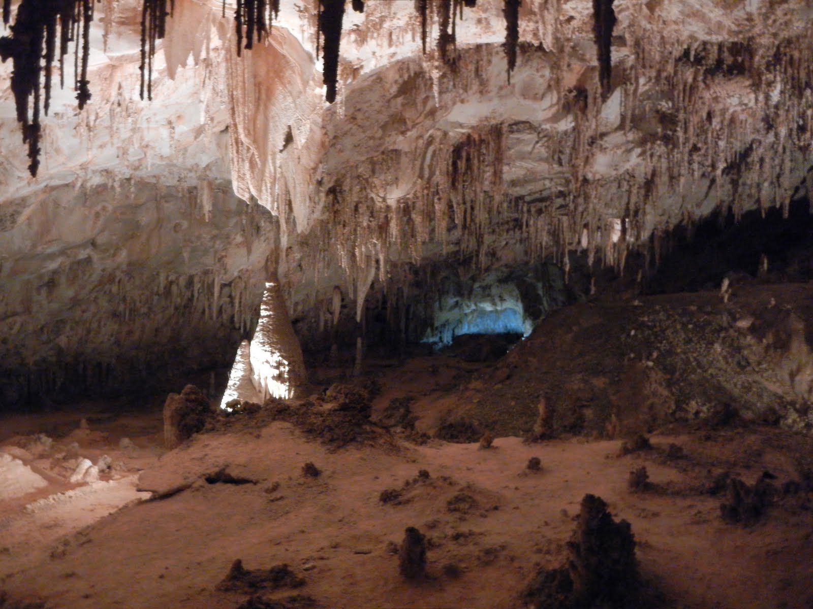
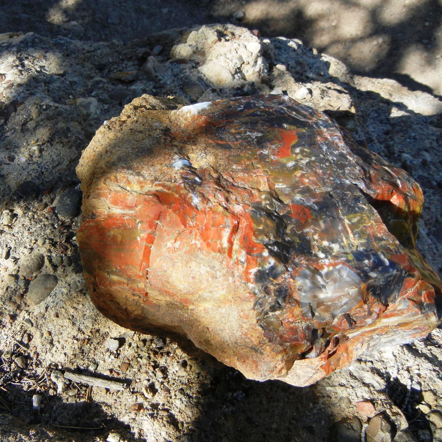
We needed to stay one extra day there to wait for our preferred option, the Escalante Petrified Forest State Park, which didn't have space for that day.  We stayed in Escalante partly to visit a friend of Ivy's who lives there and partly to access the Bryce Canyon National Park nearby.  We hiked the Escalante park to see an elaborate collection of petrified wood, and enjoyed dinner with our friends and lunch in a local restaurant.  We also took a very nice tour of historic houses.  None of these were very grand, but they were lovely and had some fascinating history.

Bryce Canyon was covered in a single long day trip from Escalante.   We began by driving to the end of the canyon overlook road and enjoying the views from that spot.  They are amazing - you can see all the way across the Colorado plateau and down into the canyon.  The wind was blowing strongly across the bluffs, and we stopped for a picnic after a windy walk along the cliffs.  From there we worked our way back, stopping at most of the overlooks provided for tourists and snapping photos all the way.  The final view was the most dramatic, the so-called Bryce Amphitheater, a formation made up of hoodoos, individual human-like figures carved of sandstone, piled up around the canyon like a huge audience gathered in a theater for a performance.  It's quite a sight, and clearly one of the most popular views with the public, who were there in force.


We explored the country around Escalante, which is largely made up of the Grand Staircase Escalante National Monument, many thousands of acres of open land and gravel roads that are a bit challenging for our little tow car.  But we drove out to the Devil's Garden at sunset, a lovely valley of hoodoos set against a backdrop of a dramatic mountain range along the Hole in the Rock Road.  And we hiked one of the trails down along a canyon that carries one of the tributaries to the Escalante River.


Leaving Escalante, we drove the RV up and over the highway from Escalante to Boulder.  This road is well known for being steep and a bit treacherous, with 14% grades in several places and a hogback at the top with steep drops on both sides.  I was a bit nervous about driving it with the RV, but the rig performed flawlessly and we continued on over Boulder Mountain to the town of Torrey, located at the entrance to the Capitol Reef National Park.  This was our last national park in Utah, so we made the most of it.  The park is one of the less visited ones, but is dramatic and spectacular all the same.  And the remarkable thing is that the area all around the park is just as dramatic and sometimes more so.  The town of Torrey is surrounded by mesas and bluffs in red rock that could be a national park all on their own.  Our RV park had spectacular views in all directions.

Much of the park was originally a Mormon settlement, in which huge orchards were planted to provide fruit to the surrounding communities.  A unique feature of the park is that the orchards are being maintained in good condition, and park visitors are allowed to pick fruit from them when they visit.  Unfortunately, we were in the park a bit too early, and nothing was ripe yet.  But the orchards were lovely green oases in this desert country.

We drove to the end of the canyon road and hiked a canyon that was used as a pass through the mountains by early settlers.  There was one of those pioneer signboards where travelers left their names and dates carved in the rock.  The weather was hot that day, and our enthusiasm gave out after awhile and we headed back, but the views were endlessly overwhelming.


But our most exciting drive was along the so-called Waterpocket Fold, a huge wall of rock that was created by geological uplift and folding and created an intimidating barrier to early settlers, who had to spend a lot of effort figuring out ways to get through it.  The road that we traveled was a long and rather rough gravel road, leading along the face of the wall and turning inward at one of the Grand Staircase Escalante roads that climbed the face up to the top and its sweeping views.  We had a lunch picnic at the top of the grade, looking out over the valley and mountains beyond.

On the way back, we stopped at a short slot canyon along the road.  These slot canyons are a distinguishing feature of this area, narrow towering canyons cut by runoff that slice through the high canyon walls.  Some extend for very long distances, but most of those are difficult to get to, so we settled for this accessible alternative.  We found the roads through this country endlessly amazing and dramatic.  The country is cut through by canyons, mesas, bluffs and carved formations of every kind, and the views are so unending and varied that you can wear out your digital camera and never get to the end of them.

The next day, we embarked on our run back to Seattle.  The goal was to travel rapidly through the rest of Utah and Nevada to California, where we will visit the Kings Canyon and Sequoia National Parks.  And then a visit to family in northern California, and the run back to Seattle.  Home by July 1.  It's hard to believe that it's ending, but we are both quite ready to be home.

Sunday, June 12, 2011

Arizona and the Grand Canyon


Leaving New Mexico, we headed just across the Arizona border to the Canyon de Chelly area.  We were able to stay right in the National Monument at a lovely little campground near the river with lots of trees but not much in the way of hookups for our utilities.  We spent several days there sightseeing in the canyon, which is dramatic but also very approachable and easier to get around in than the more enormous canyons that we intended to visit further on.  We explored the rim and took a lot of photographs down into the canyon. 

This canyon is jointly managed between the Navajo Nation and the Park Service, and some of the Navajo still use parts of the canyon for agricultural and tribal purposes, as well as living there during the summer.  The Navajo have most of the concessions in the park, including the jeep tours, and they are in the process of taking over the campground itself and managing that as well.  Navajo vendors are all over the park areas, selling various handmade items as well.  We took one of the jeep tours, driven by Sally, a Navajo grandmother of 44, great grandmother of 12, and we enjoyed it thoroughly.  She was a mine of tribal stories and history, and gave us some real insights while we drove around the canyon. 

From Canyon de Chelly, we moved on to the Big Kahuna, the Grand Canyon National Park.  This had been Ivy's number one goal on our trip, and it did not disappoint.  We were able to get a campsite inside the park, at one of the RV parks maintained by the Park Service.  That was very helpful, as it put us close to the South Rim and able to run back and forth as needed to take our hikes and our shuttle tours.  We were even able to bike to the visitor center.  The weather was not perfect - we even had snow one evening and part of the next day, and the wind varied from peaceful to gale force.  But the sights lived up to their reputation.

Ivy and I are past the age when we could undertake the 15 mile hikes to the canyon floor and back in 100 degree heat. But we admired the hardy hikers from a distance and took some pictures of them and the burro trains that went up and down those death-defying trails.   For the most part, we stopped at scenic overlooks or hiked along the rim on the trails that they have laid out there.  And Ivy spent quite a bit of time on sunset and sunrise pictures, trying out different sites and looking for that perfect Grand Canyon sunset.  There are so many overlooks along the rim that it's hard to get to them all. And each one has a unique view to offer.

And of course, we did a bit of shopping and ate in a restaurant or two.  There are some fine lodges located right in the park and their restaurants are very respectable.  And the trinkets are appealing, if a bit overpriced.  The geology of the area is endlessly fascinating.  I bought a copy of the most popular book there, available in every gift shop.  It's called "Over the Edge:  Death in the Grand Canyon", and it is quite well written by two authors who have worked in the Grand Canyon for many years.  You couldn't ask for a more comprehensive compendium of human frailty, hubris, carelessness, poor judgment, and bad luck.  No wonder it's so popular. Hopefully, people learn from it and do better in the future.  But we saw plenty of folks playing on the edge while we were there, and I think that sort of behavior is just programmed in.

From the South Rim, we headed down to Flagstaff, Arizona for a short stay.  I got some bike repairs done, and we worked on a problem with the house batteries in the RV.  We did a bit of sightseeing and visited the Museum of Northern Arizona, a well known and regarded museum with a great collection of Arizona artifacts and stories.  They had a great church with pink marble, too. 


But a lot of our attention was focused on a side trip to Sedona, Arizona.  The town is famous as a tourist Mecca, and it is very beautiful, with a dramatic setting.  The drive down there is through a scenic canyon with wonderful views, and there are massive mesas and formations all around the town.  And there are a lot of tourist facilities, back country pink jeep tours, restaurants, ice cream palaces, etc.  One of our favorite sights was the chapel built into the side of the mountain just outside town.  It takes full advantage of its fabulous location and attracts numerous tourists.  One of those was a watercolor painter that we met, who, it turns out, is from the Seattle area and involved with a watercolor group in the northwest.  So Ivy and he had a long discussion and we picked up some information for Ivy when we return. Ivy also found a great little shopping area, built in an old Spanish village setup, with lots of tile and very charming buildings. 


Our next stop was Page, Arizona, located right on Lake Powell and the Glen Canyon Dam.  The area is quite pretty, and we spent some time looking around and taking short hikes.  We even got our feet wet in Lake Powell.  But the big attraction was the rafting trip down the Glen Canyon, just below the dam.  This is a smooth water rafting trip, befitting our advanced ages and peaceful natures, but it is very dramatic and fun.  The guide was a fountain of great stories and knew the route well, having lived in Page her entire life.  The water in the river was freezing cold and splashed on us occasionally, but with the heat and the dryness, recovery was almost instantaneous.


We  spent several hours on the river in this raft, and pulled out again at Lee's Ferry, which is the last spot you can get serious vehicle access to the Colorado River for some 300 miles.  After Lee's Ferry, the rapids and the Grand Canyon begin and it is a very long way before the river becomes accessible again.   I was surprised to learn that almost half a million people have taken that rafting run over the time that trips have been available, given the challenging nature of the trip and the dangers involved.  But it seems that river guides have almost entirely mastered the art of rafting the Colorado.  And tourists love the trip.  On the way back to Page, we crossed the Navajo Bridge, the last crossing of the Colorado River for hundreds of miles.  From that vantage, we got a look at the intrepid souls who were heading down the river. 

Following Page, we launched ourselves up the mountain again to the North Rim of the Grand Canyon.  We stayed outside the park this time, in a very lovely RV park in the little crossroads town of Jacob Lake.  It was close to the park and allowed us to explore some of the local area as well as travel the North Rim.  The weather turned cold again, and we had at least an inch or two of snow one night.  But the days warmed up and we were able to drive around and sightsee without much trouble.  Though the altitude made hiking more strenuous than it usually is.

Our favorite part of the visit  was a drive along the road that borders the eastern part of the park.  This road affords views not only of the Grand Canyon itself, but some dramatic vistas of the approaches to the park and the formations that lead from the Glen Canyon Dam down the Colorado through Marble Canyon.  The view points are among the highest in the Park and the most dramatic.

I am continually impressed by the geology of the western United States.  The scale of these geologic events is so enormous and dramatic that it takes your breath away.  And it extends for hundreds of miles, changing its form and color as it moves but always overwhelming and impressive.  From here we take in some more dramatic sights in southern Utah.  We will be heading to Zion, Bryce Canyon, and Capitol Reef National Parks.  Then it's off to California and then home.  We're almost at the end.  It's hard to believe.  

Wednesday, June 1, 2011

New Mexico Travels


Our trail led us north through the wilds of New Mexico.  On our way to the first stop, we delayed a little while in famous Roswell, New Mexico.  This is the town that has taken full advantage of its reputation as Alien Central.  There was a whole section of main street devoted to alien gift shops and tourist stuff.  There was a UFO Museum, inflatable alien dolls, the whole nine yards.  We stopped for lunch but resisted the urge to load up on alien tchotchkes.  We also stopped at the Smokey the Bear statue along the highway.  It turns out that Smokey the Bear was a real bear cub who was rescued, partly burned, from a Lincoln National Forest fire in the area, and whose story launched much of the Prevent Forest Fires movement.  Who knew?


Our first layover was in the town of Carrizozo, where we took up residence in the Valley of Fire Recreation Area.  This was a lovely campground in the middle of a lava field that was formed as lava oozed out of the earth eons ago.  The campground had the most spacious bathroom and showers that we have ever seen in a campground and was very reasonably priced with sites that had a dramatic view of the desert around the town.  Carrizozo has a history as a movie set town, dating back to 1923, when Eric von Stroheim apparently made a film in the town.  The local film buffs keep track of the films made in the area and in New Mexico, and one night while we were there, a group of them put on a showing of an old western that had been made there.  We were able to attend also and thoroughly enjoyed the showing, set up in an improvised theater in the community hall.

While in Carrizozo, we took a car trip down the road to White Sands to see the famous National Monument.  On the way we stopped at the Three Rivers Petroglyph site, home of over 20,000 petroglyph drawings made by the ancient peoples who inhabited this area thousands of years ago.  The trip also offered some pistachio nut groves, where we loaded up on fresh pistachios for ourselves and a few bags to mail to friends.  Best was the National Monument itself.  We took the auto tour and climbed the blinding white sand dunes, then took a guided walk through some natural areas where the dunes are still advancing.


There were some dramatic windstorms while we were in Carrizozo, and our campsite up on a hill was quite exposed to them.  We wound up staying an extra day because of forty mile per hour winds all day with gusts of sixty or more.  That kind of weather is not good for RV's, as they blow around a lot more than a passenger car.    So we hunkered down and waited for the winds to die down.  Fortunately, they eventually did, and we were able to move on to Albuquerque.

Our RV park in the Albuquerque area was right on the old Route 66, which is prominently labeled in the town and provides a lot of local cachet.  Our RV park used to be an old trading post along the route and has been expanded to an RV park which also provides some vintage RVs and some historical gossip and trivia.  The town itself provided some resources for us after our long stay in such remote areas.  We found a good organic food store, I was able to get some medical tests done, we picked up mail, and we got some repairs done on the RV steps, which had been giving us trouble the whole trip.

But it certainly wasn't all business.  Albuquerque is located right on the Rio Grande and there are some great bike paths and parks all along the river.  They've left the area pretty much wild cottonwood forests like the environment years ago, and there are some nature centers that provide information and advice about how to find the critters and the birds.  I took a long bike ride along those trails and had a great time.

Ivy enjoyed the Old Town and took advantage of it to do some painting.  It's a very historic area, with lovely old adobe buildings, a nice public square, and of course, lots and lots of shopping.  We also had a couple of restaurant meals near there, emphasizing Mexican cuisine.

From here we headed north to the Santa Fe area.  We got an RV park in the town of Pojoaque, just north of Santa Fe, and used it as a base for side trips to both Santa Fe and Taos.  Much of the land in this area is reservation land, so there are casinos pretty much everywhere, some truly gigantic in size. 

We were much more interested in the string of  pueblos that had been built by the Spanish and the Indians over hundreds of years.  The oldest one, in Taos, still maintains a section devoted to keeping the practices of the old pueblos alive.  They have no electricity and no running water in this section, which is the oldest continually inhabited pueblo going.

Taos is an amazing town, and we loved it.  We paid a visit to some of the local historical sites and museums, including the Millicent Rogers Museum, which houses her collection of turquoise and silver, as well as some wonderful pottery work from Native American sources.  We visited the famous church of St Francis of Assissi in the center of town, and explored the streets and byways. 


Santa Fe got a bit less attention, but we found that we enjoyed it a lot more than we had expected.  There is a very good feel to the town once you are not in the most touristy section, and the people are very cultured and friendly.  There is so much history here that you can learn a lot about the area while enjoying a very civilized city.  We found a great pizza place, which did a lot to put us in a good mood, since good pizza has been a rare find. But the best was Museum Hill, an area that has been developed into an elaborate complex of museums located on a local high point with great views.  Our favorite of all of them was the Museum of Folk Art, an amazing complex of exhibits base on a collection of folk creations from all over the world.  The exhibits were absolutely brilliant, arranging sometimes hundreds of different pieces in large, complex "cities" or "villages" that showcased the work while placing it in a unique context.  What a place!


We took a day trip to the Bandelier National Monument, near Los Alamos.  One of the ancestral pueblo settlements in the area, it has a unique environment of cliff dwellings made of "tuff", a volcanic material that is easy to work and develops elaborate swiss cheese look from erosion.  Natives used it to build their dwellings, but also hollowed out rooms in the cliffs for storage or additional living arrangements.  We ran into lots of kids doing school trips here, and we had to admire the adults who were constantly busy keeping the little urchins from getting into trouble. 

Leaving this area, we headed west and stopped briefly at the Bluewater Lake State Park in Prewitt, New Mexico.  Once again, a great little state park in the middle of a vast desert, not very populated. We took a car trip to the El Morro National Monument, site of the Signature Rock, where travelers for centuries engraved their names as they passed through.  Here also we got our first view of the white-throated swift, a bird of high cliffs and canyons.  They are billed as among North America's fastest birds, with speeds up to 200 miles an hour.  We climbed the trail leading to the top of the cliffs, which gave me some trouble but we got down fine and had some great views from the top.

From here we are headed to Arizona and the Grand Canyon, a goal from the very beginning of the trip.

Tuesday, May 24, 2011

Big Bend and the Carlsbad Caverns

Apologies for being so late with this post.  We have had a long string of bad wi-fi connections and computer problems.  We hope that those are over now, and we will get up to date quickly. 

We traveled next to the Big Bend National Park, an enormous park along the Rio Grande River in a very remote section of west Texas.  West Texas is desert country, thinly inhabited.  The weather there has been very dry for the past year, and fire danger was at an all time high throughout the region.  While we were there, fires raged all over nearby territory, though there were none in the park itself.  There were fires on the Mexico side of the Rio Grande totaling a million acres or more, and others on the US side with many tens of thousands.  The sky was almost always brown with smoke and sometimes even the nearby mountains could barely be seen.  We kept a careful eye on fire alerts the whole time we were in the area.

Our first stop was just outside the northern entrance of the park, at the Stilwell RV Park, Store and Museum.  This spot was very remote and had only a few RV sites, but we enjoyed it thoroughly.  The family had set up a museum honoring one of their ancestors, Hallie Stilwell, a pioneer woman who worked the ranch in that area for many years before the park was even formed.  There were some wonderful stories about her and the ranch, and we learned about the schemes that her family used to keep the ranch from being included in the park when it was set up.    We took a ride down to the end of the ranch road, which terminated at the Mexican border near the ghost town of La Linda.  This town used to supply minerals to US industries, but was undercut by the Chinese and the border is now closed and the town fallen into ruins.

We began  our exploration of the park with a trip to the Rio Grande Valley campground right on the border.  Daytime temperatures were very hot, usually over 100 degrees, so we had a tendency to lay low during the heat of the day.  But the campground had a lot to recommend it, and there were sites available in the full-service part of the park, so we decided to move down to that area and stay for a few days to explore the neighborhood.  The bird migrations were in full swing, and we looked for as many opportunities as we could to join others for birding walks, or get tips on where to see good birds.  One of our favorite sightings was a little elf owl, the smallest owl in the world, which lived in the top of a local telephone pole.  Every evening the local birders would gather and wait for sunset and dark, when the little fellow would pop his head out of his hole, sing for awhile, and then fly off into the night for some hunting, to be replaced by his mate for the evening. A rare treat. 

Ivy did some painting in the area as well.  She found a good spot at an overlook, but found that she was constantly interrupted, either by groups of motorcycle enthusiasts, who were cruising the park, or by the local Mexican craftsmen, who would sneak across the border to sell their wares.  It seems that the Big Bend Park used to allow all kinds of travel back and forth across the border.  Tourists went to Mexico for lunch and some crafts, and Mexicans came over to hawk their wares.  That all changed with 9/11 and the border has been closed all the way to Presidio, over a hundred miles away.  But the craftsmen sneak over anyway and leave their wares along the trails with little bottles for you to put your money in.  But they have to flee if they see the park rangers coming.  Along here the Rio Grande is about ankle deep, so there's not much of a barrier to crossing.  

After a few days we moved to the other side of the park, to a town called Terlingua.  This is a bit of a hippie town, with a very different feel than the rest of Texas.  It looks and feels a lot like New Mexico, right up to the silver and turquoise jewelry and the adobe houses. It is very laid back, with a colorful ghost town and cemetery and some pleasant restaurants and shops.  But it continued very hot, with daytime temperatures over 100, so everyone was a bit lethargic in the middle of the day.  There was a lovely old trading post at the top of the hill with a large shaded front porch, where everyone gathered in the late afternoon to re-hydrate and gossip. 

The ghost town in Terlingua was well worth seeing also.  Some of the buildings have been rehabbed and are still inhabited, but many are falling down.  There is a large and ancient cemetery, dating from the time when the town thrived with mining activities, now all gone.  We had a nice dinner in a well-known restaurant there that is built half underground and keeps cool with earth based design.  An interesting place.


We visited the west side of the Big Bend Park from here, traveling up into the Chisos Mountains, where there is a lodge and some good birding, and also traveling down to the western part of the park by the river, site of the famous Santa Elena gorge, a dramatic canyon cut by the river through the huge bluffs.  We hiked a bit there, but were finally turned back by the heat.  There was a lot of climbing to the trail, and no water, so we made a strategic retreat and held a picnic down by the river in the Cottonwood camping area.  There we saw our first gray hawk, a small tropical hawk that only comes a few miles into the US from down south.  It is a gorgeous little creature and we got lots of fun out of seeing it.

While we were here, we took a canoe trip down the Rio Grande River.  We went with a guide company and several other folks and spent a half day on the river.  The river was quite low, and even with shallow draft canoes we kept dragging along the bottom and sometime needed help from the guides negotiating some of the shallow spots.  It was a gorgeous day, and one of the highlights was a picnic on a river sandbar set  up by our guides. After the trip, we proceeded to the town of Presidio on the border, and looked in on an old fort there with an excellent historical exhibit covering the era of Pancho Villa and its impact on the border areas. 

From Terlingua, we headed north to the Carlsbad National Park area.  We stopped off in the town of Pecos, where we visited the West of the Pecos Museum, a great resource that has been put together with loving care by the local history buffs.  There's plenty of history there and stories of the old west.  And quite by chance we found an excellent tamale factory nearby where we ordered a half dozen of their finest.  The tamales were too spicy for Ivy, but yours truly dined off them for several days.

We stayed in a small RV park in White's City, right outside the national park boundaries.  We spent a lot more time in the caverns than we had originally thought we would, because we found them so dramatic and fascinating.  They were quite different from the previous caves we had toured in other states during earlier parts of the trip.  Formed by sulfuric acid created by water combining with the local oil and gas in the ground, these caverns are orders of magnitude larger and more dramatic that we had seen in the past.  We signed up for several tours and also came by in the evening for the bat flights out of the caves at dusk.


There was a lovely park nearby that was part of the caverns national park land, but separate from it and some miles away.  It was a great place for mid-day picnics, as the weather continued quite hot, and the middle of the day required some nice shady spot with lots of cottonwoods, shade and a small stream running by it.  We used this site several times, and Ivy also found it a good source of painting material. 

From here, we headed north across the New Mexico border, headed for the Taos and Santa Fe areas and hoping for a bit milder weather at their higher altitudes.